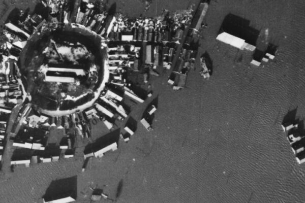
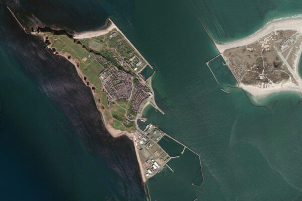
Aerial photographs of Helgoland before and after the bombing in April 1945.
On April 18, 1945, the German North Sea island of Helgoland was hit by one of the heaviest Allied bombings of World War II. What had once been a bustling island with homes, harbors, military installations, and defensive works was transformed within a few hours into a landscape of rubble that was virtually unrecognizable.
During the war, Heligoland played an important strategic role for Germany. The island guarded access to key naval ports along the German North Sea coast and was heavily fortified with anti-aircraft emplacements, radar installations, bunkers, and an extensive network of underground tunnels.
In the final weeks of the war, the British Royal Air Force decided to neutralize this stronghold once and for all. On April 18, 1945, hundreds of British bombers appeared over the island. In a short period of time, thousands of metric tons of explosives were dropped on an area of just a few square kilometers. Virtually all above-ground structures were destroyed.
Although the material damage was enormous, many residents were able to survive the attack thanks to the deep bomb shelters and tunnels that had been built in previous years.
Helgoland from the air
Historical aerial photographs clearly illustrate the impact of the bombing. While images taken before April 1945 still clearly show buildings, infrastructure, and military installations, aerial photographs taken after the attack reveal a landscape littered with craters, rubble, and collapsed buildings.
Comparison of Aerial Photos
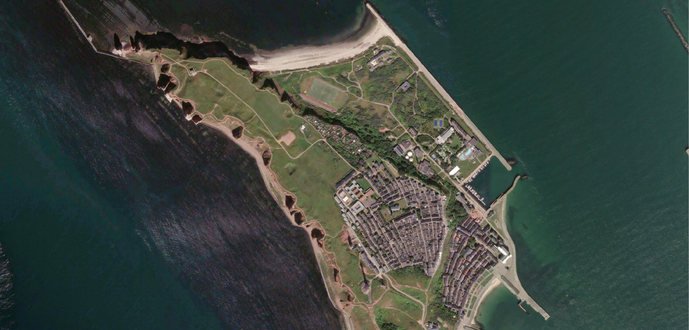
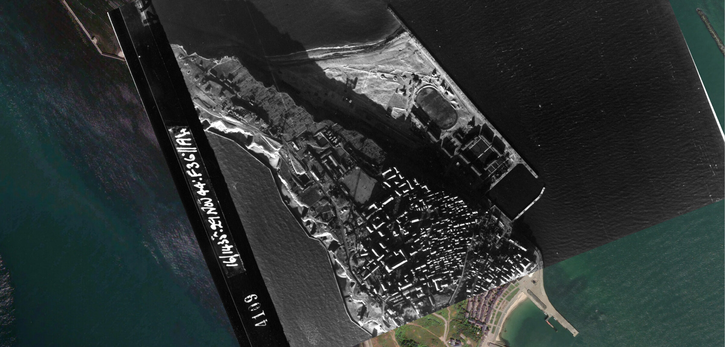
Above: Helgoland, photos from November 20, 26, and 29, 1944 ©Dotka
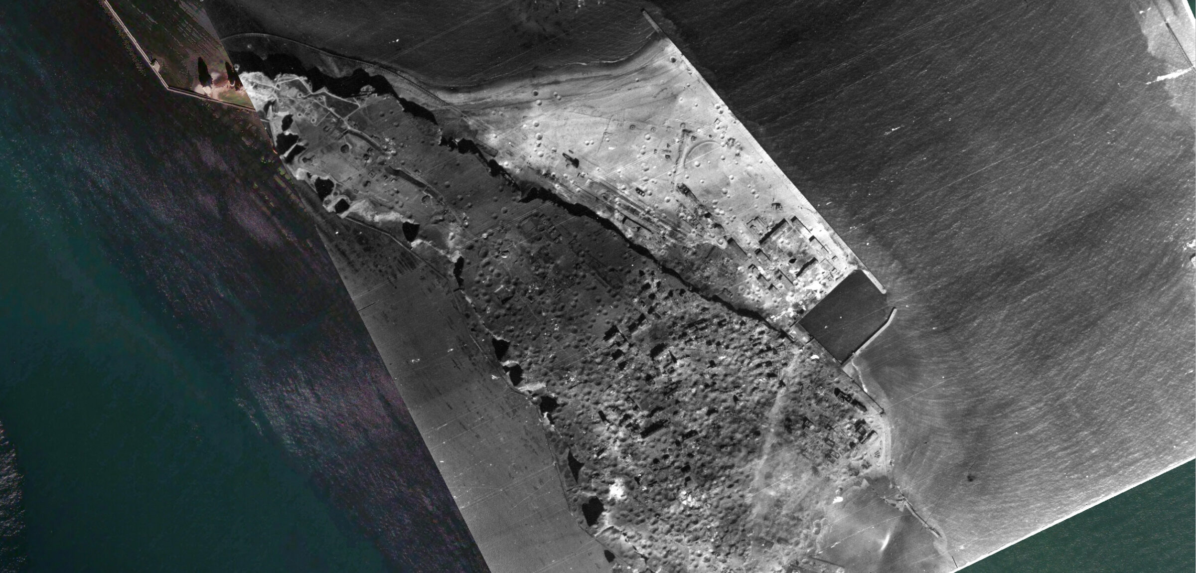
Above: Helgoland, April 19, 1945, one day after the 1944 bombing ©Dotka
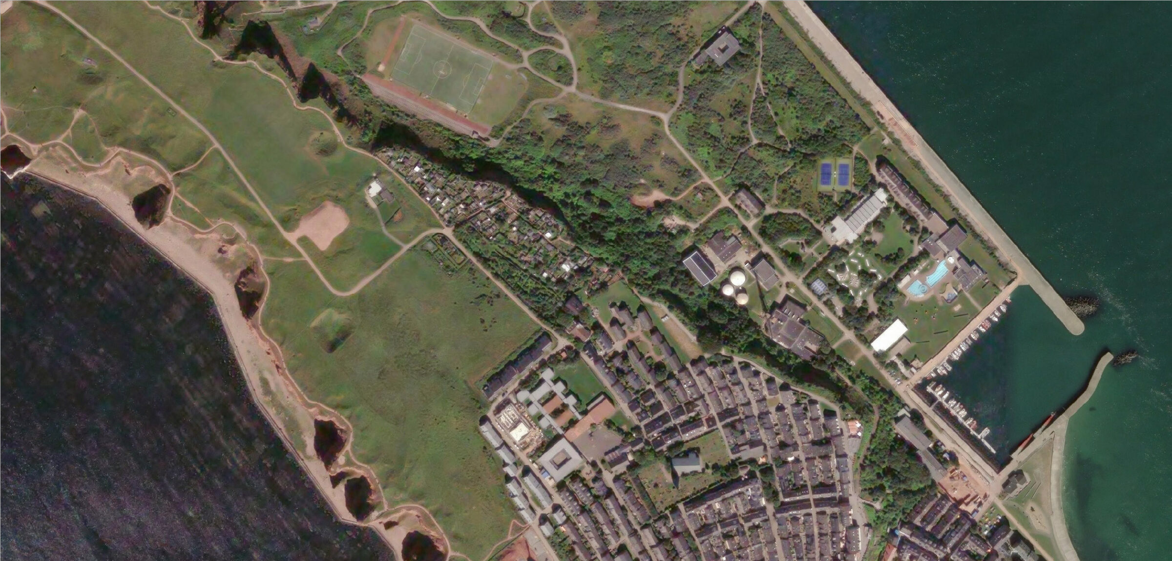
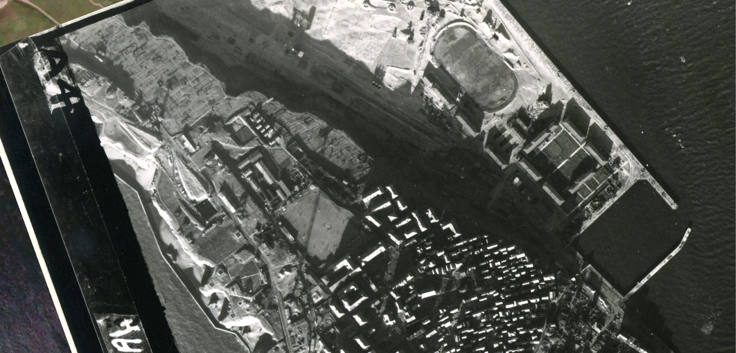
Above: Zoom 2026 and November 29, 1944 ©Dotka
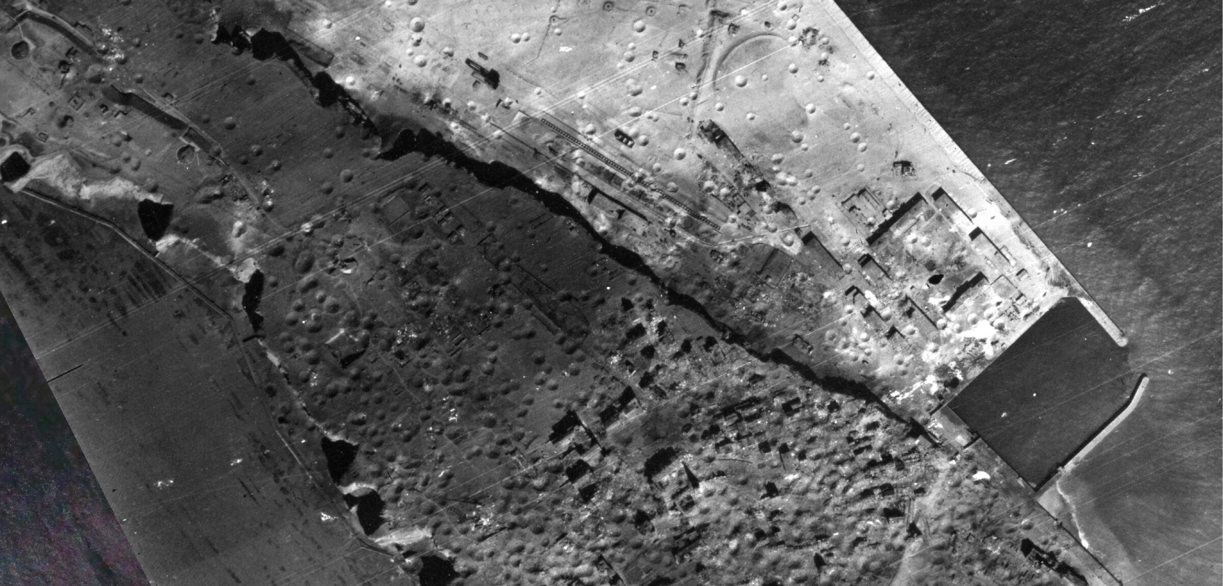
Above: November 29, 1944, and April 19, 1945 ©Dotka
The comparison shows just how drastically the air war transformed the landscape of Helgoland. Roads, buildings, and entire residential areas disappeared or were severely damaged. The military infrastructure is also clearly visible in the aerial photographs.
It's not over yet
The bombing in April 1945 did not mark the end of the destruction. After the war, the British used the abandoned island as a military training ground and a storage site for leftover ammunition.
On April 18, 1947, exactly two years after the massive bombing, a huge quantity of collected explosives was detonated in what later became known as the “Big Bang of Helgoland.” The blast was not limited to Helgoland itself. Residents of the German North Sea coast heard the explosion on the mainland as a heavy, muffled boom. Windows rattled, doors shook, and the shock wave was felt over a great distance. With approximately 6,700 metric tons of explosives, this was one of the largest non-nuclear explosions in history.
The explosion destroyed a large portion of the remaining military installations and permanently altered the island's landscape. Parts of the cliffs collapsed, and the island's topography was visibly altered.
Historical aerial photos as a time machine
Historical aerial photographs are a unique resource for studying war damage and changes to the landscape. The aerial photographs of Heligoland show at a glance just how drastically the April 1945 bombing raid transformed the island. The aerial photographs of Heligoland not only reveal the consequences of one of the heaviest bombing raids during the final phase of World War II, but also illustrate how a landscape evolves in the wake of a traumatic event.
For researchers, historians, and anyone interested, these recordings offer a unique glimpse into a crucial period in European history.
Sources and further information
- Municipality of Helgoland – History of the Island
Official history page of Helgoland. Contains information about the bombing of April 18, 1945, the evacuation of the population, and the explosion of 1947. - Helgoland Genealogy – The Destruction of Helgoland on April 18, 1945
A detailed historical reconstruction of the bombing, including the number of aircraft, the duration of the attack, and eyewitness accounts. - National Geographic – When the British Tried to Blow Up an Island
Background article on Helgoland, the island’s military significance, and the explosion during Operation Big Bang in 1947.
Visual material
Historical aerial photographs of Helgoland from the collection of Dotka Data BV, including images taken before and after the bombing of April 18, 1945. These aerial photographs clearly show the extent of the destruction and the subsequent changes to the landscape.
Current reference images: © Esri World Imagery.
Historical aerial photos: © Dotka Data BV.